
Water
Water
Aquila uses the latest remote sensing tools and provides customized water quality monitoring solutions, which allow quantitatively studying complex biophysical and biogeochemical processes in open-ocean, estuarine, coastal, and inland waters. In particular, Aquila processes imagery collected by satellite, airborne and drone imagery to develop different indices for water quality.
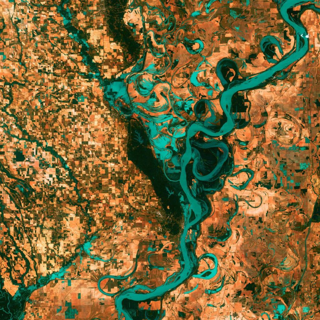
Water is a valuable natural source which is used for drinking, irrigating, producing electricity, and etc. Only three percent of the world’s water is suitable for drinking, 2 percent of which is stored in glaciers and ice. Thus, one percent of the Earth’s water is accessible and portable, requiring a detailed water quality management. Lakes are a vital resource for providing drinking water and they are important for fishery industry. Water quality monitoring in lakes have been influenced by a phenomenon which is known as Harmful Algal Bloom (HAB). HABs are deleterious phenomena characterized by the rapid accumulation of biomass in aquatic systems that have been escalated worldwide in recent years. They have become a major health and environmental concern in lakes. Thus, monitoring HABs is of paramount importance. The transient nature of HABs, in both space and time, results in monitoring challenges and thus adds to difficulty in scientifically understanding the ecological criteria that trigger HABs. Compared with traditional in situ point observations, satellite remote sensing is considered as a promising technique for studying HABs due to its advantages of large-scale, real-time, and long-term monitoring.
Aquila recently developed a processing pipeline for satellite imagery to detect high toxicity HABs existing in thin layers and to identify high-biomass HABs such as red tides. In this project, we used Earth Observation (EO) data acquired by optical, radar, and UAV imagery as well as in-situ data, including spectrometers and water sampling data. Space and air-borne remote sensing data, particularly the spectral reflectance of optical sensors represent an effective way for monitoring phytoplankton by its proxy, chlorophyll-a, the green pigment that exists in all algae. Therefore, high spatial and temporal resolution imagery used in this project provided valuable information for HAB monitoring purpose.
Forest Monitoring
Forest Monitoring
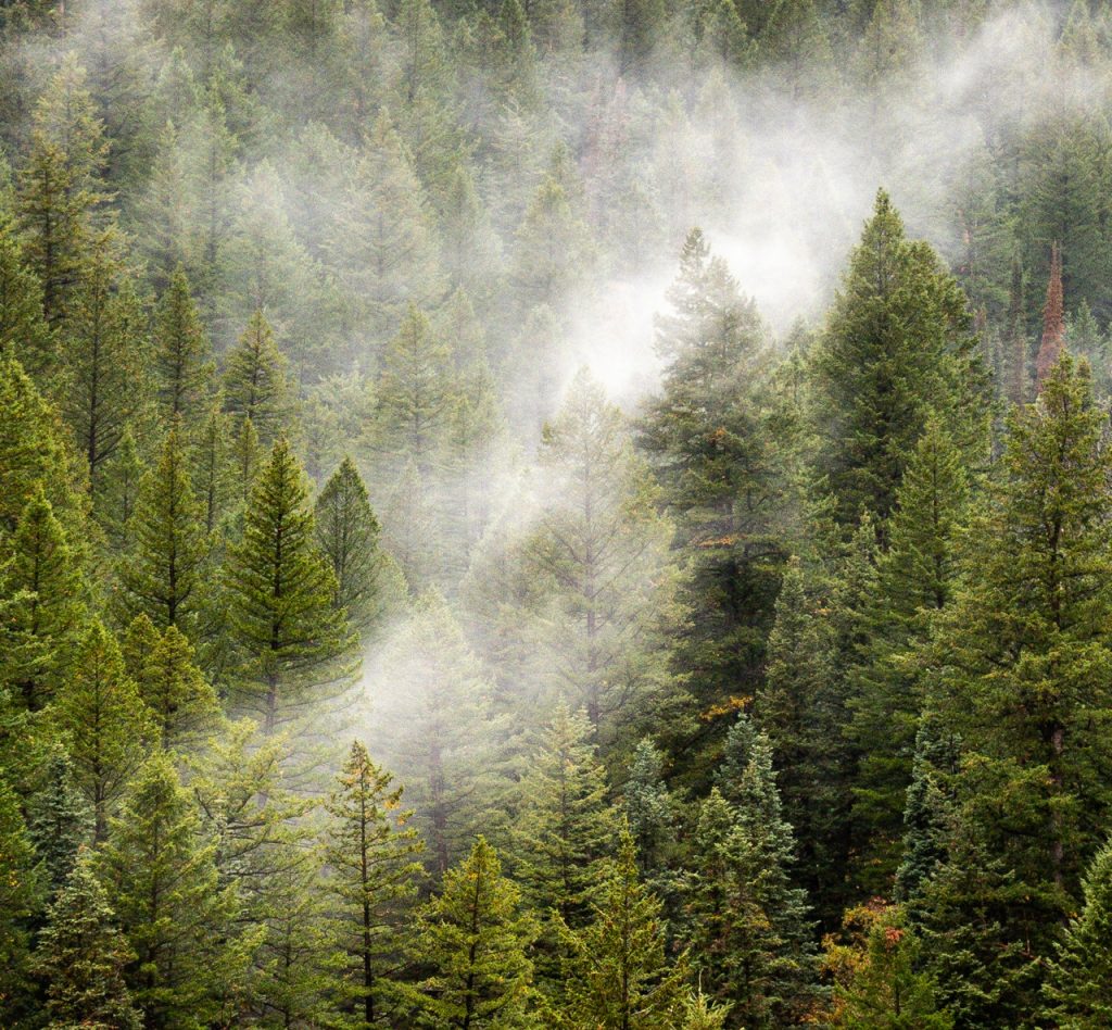
Aquila uses state-of-the-art remote sensing and machine learning tools to provide useful information on global forests. Forest is one of the most important natural resources covering nearly one-third of the Earth’s surface. Due to the important role forests in the carbon cycle and sequestration, they have long been investigated in the context of global climate change. In other words, forests absorb nearly one-twelfth of the total Earth’s atmosphere carbon dioxide stock, most of which is stored as woody biomass or cycled into the soil. As such, forest biomass estimation is of paramount importance as it regulates the climate and keeps the Earth green and healthy.
Forest above-ground biomass (AGB) is one of the forest biophysical parameters that is widely studied, since it provides invaluable information for understanding ecosystems functions and carbon cycling. Thus, accurate AGB measurement and analyses are critical components in qualifying carbon stocks and sequestration rates. In general, there are two possible ways of AGB estimation. One traditional way to address the problem of AGB estimation is field measurement, which is an expensive, costly, and destructive process. Remote sensing is one of the geospatial technologies that is paving the road for the development of AGB estimation methods. Optical, radar, Unmanned Aerial Vehicle (UAV), and Light Detection and Ranging (LiDAR) are valuable remote sensing tools, which are used for accurate AGB estimation.
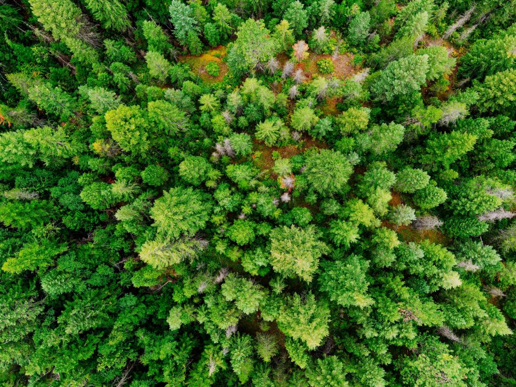
Tree crown detection is another forest related service provides by Aquila’s experts. Tree crown detection has become a major area of research in image analysis, considering the complex nature of trees in a complex environment. Single tree information is required for many scientific purposes, such as phenomena and purposes that are happening in the global forest. The new generation of satellite imagery with high spatial/temporal resolution has led to detect individual tree using advanced machine learning algorithms.